 |
 |
 |
 |


TITLE
Appendix E: MapsPrivate Forests and Public Lands in Washington State
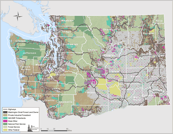
The Washington State Forestland Database demonstrates the spatial relationship between private industrial owners, small forest land owners, and public lands throughout the state. Washington Small Forest Land Owners and Forest Cover
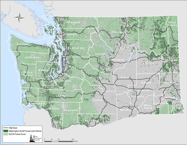
The Washington State Forestland Database demonstrates the spatial relationship between private small forest land owners and natural features, such as forest cover, throughout the state. The Percent of County Area Owned by Small Forest Land Owners
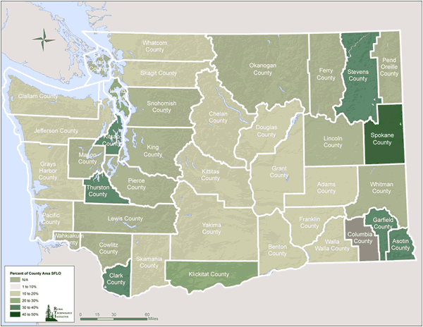
The Washington State Forestland Database can be used to calculate statistics for different areas of the State. The total area owned by Small Forest Land Owners in each County can be divided by the total area of each County. The Number of Small Forest Land Owner Parcels per County
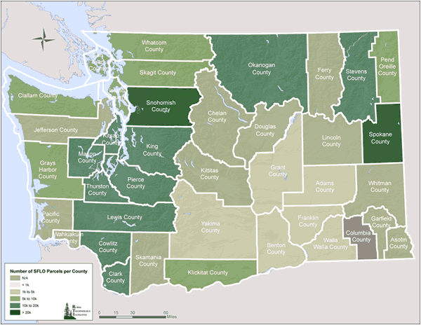
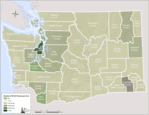
The Washington State Forestland Database can be used to calculate statistics for different areas of the State. The number of Small Forest Land Owner Parcels in each County can be counted. Small Forest Land Owner Density, Counties
The Washington State Forestland Database can be used to calculate statistics for different areas of the State. The number of Small Forest Land Owner Parcels in each County can be divided by the total area of each County. The Percent of WAU Area Owned by Small Forest Land Owners
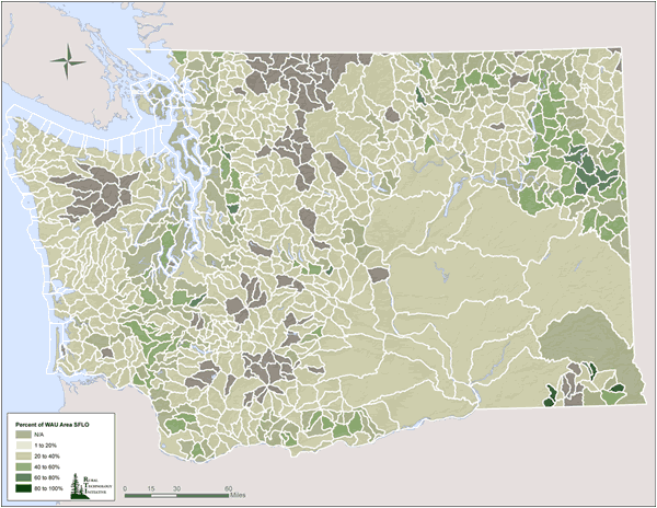
The Washington State Forestland Database can be used to calculate statistics for different areas of the State. The total area owned by Small Forest Landowners in each Watershed Administrative Unit (WAU) can be divided by the total area of each WAU. The Number of Small Forest Land Owner Parcels per WAU
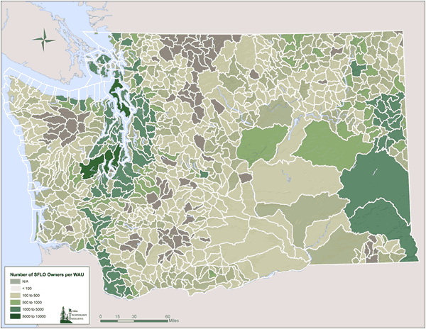
The Washington State Forestland Database can be used to calculate statistics for different areas of the State. The number of Small Forest Land Owner Parcels in each Watershed Administrative Unit (WAU) can be counted. Small Forest Land Owner Density, WAUs
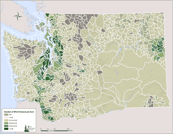
The Washington State Forestland Database can be used to calculate statistics for different areas of the State. The number of Small Forest Land Owner Parcels in each Watershed Administrative Unit (WAU) can be divided by the total area of each WAU. Continue to Appendix F
|

